Wasm Regional Center — The pace of climate change across the region continues to accelerate, driving more extreme weather phenomena, increasing the likelihood of flash floods, and significantly boosting rainfall totals — a trend expected to become clearly evident during the upcoming rainy season.
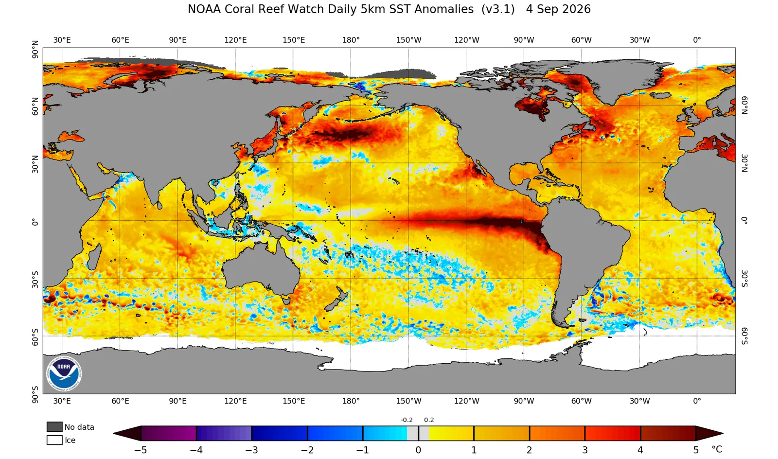
With the continued development of the El Niño climate phenomenon — which we uniquely predicted an entire year in advance as the first scientific institution in the climate research community — projections indicate that this will further intensify regional climate changes in the coming months and contribute to the evolution of the “Climate Reversal” phenomenon across the region.
Preliminary data from the Wasm Regional Center’s climate model, initialized on September 5, 2026, points to a very early start to the rainy season beginning in the last third of the current month, with significant intensification expected during October, November, and December (10–11–12). Additional important changes are anticipated during the second half of the upcoming rainy season, with details to be released in the first edition of the seasonal outlook.
A “Highly Rainy” Season
Model outputs from the Wasm Regional Center indicate a highly rainy season, building on the model’s exceptional performance in seasonal and sub-seasonal forecasting in previous years — particularly the 2025–2026, 2019–2020, and 2022–2023 seasons, during which our model outperformed all other regional climate models thanks to its flexible calibration of statistical analog periods.
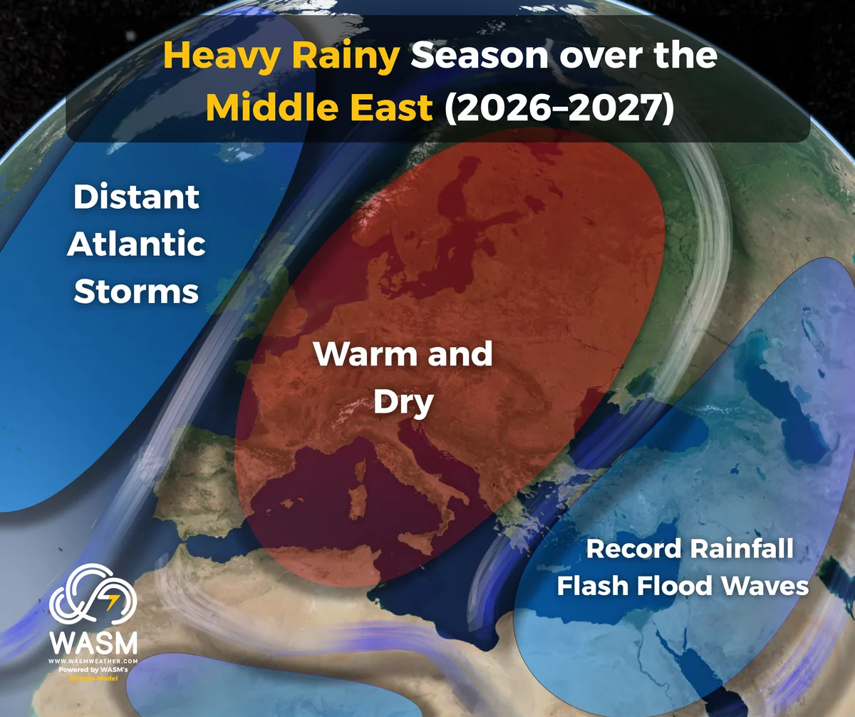
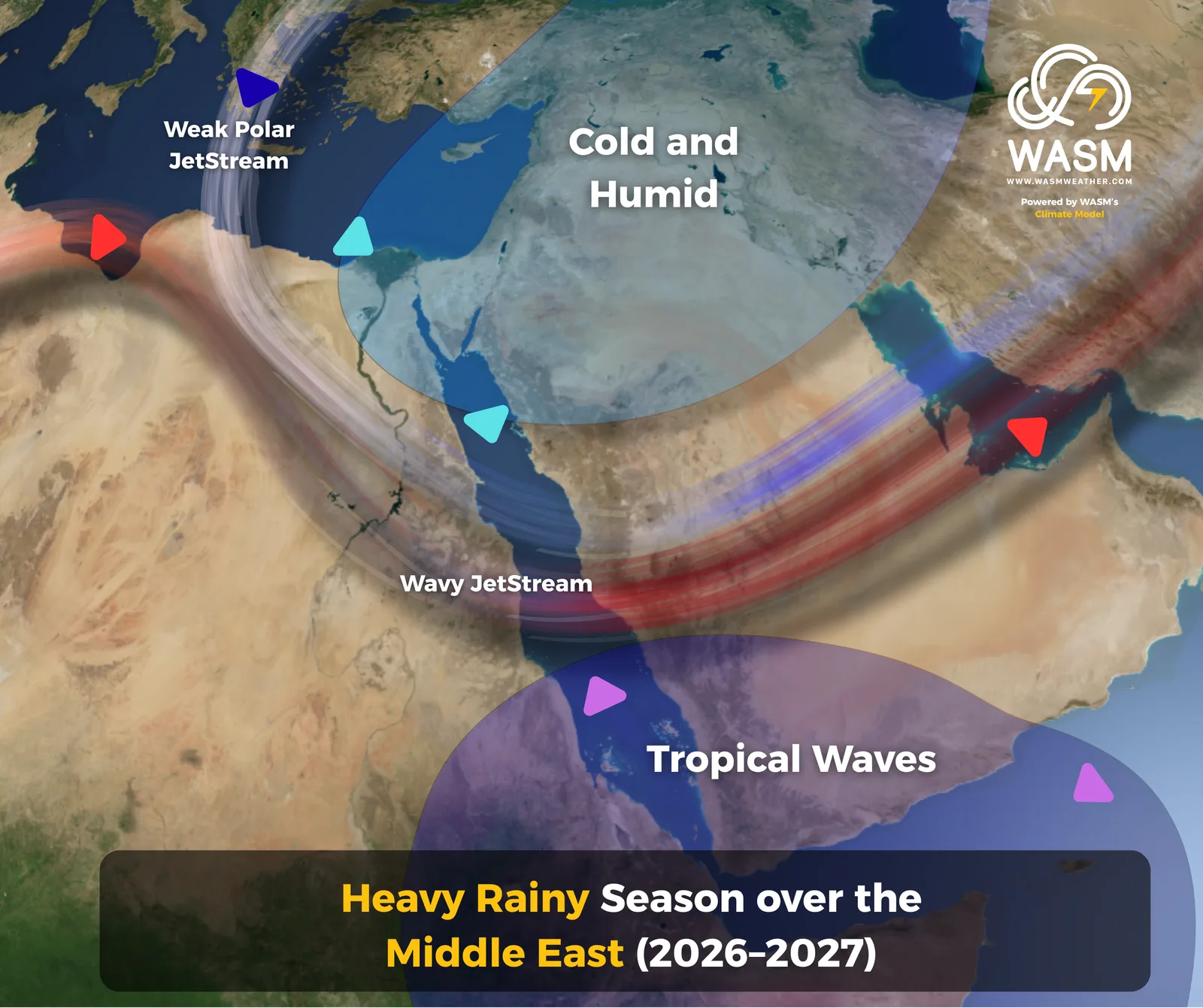
Initial results point to a very wet season across the Arabian Peninsula — especially its northern half — as well as Iraq, the Levant, and northern Egypt. The projections show a strong surge of tropical moisture driven by changes in tropical activity and circulation associated with El Niño, pushing large amounts of moisture toward the Middle East.
These findings coincide with observed major changes in the Atlantic Ocean (refer to our 2023 studies), which are causing a sharp curvature in the jet stream over Eastern and Southeastern Europe and the Eastern Mediterranean.
Initial results indicate a very high likelihood of floods, flash floods, and record-breaking rainfall during October–November–December, particularly between October 20 and December 10, due to shifting atmospheric systems. Additional changes are expected during the second half of the rainy season and will be detailed in the main seasonal bulletin.
Regions most affected by this wave of floods and flash floods include:
- Northern Saudi Arabia
- Northern coasts of the Arabian Gulf
- Central and northern Red Sea regions
- Iraq and Kuwait
- The Levant (Jordan, Palestine, Syria, Lebanon)
- Large areas of central and eastern Turkey
- Southwest Asia and Iran
- Northeastern Egypt
The first half of the season is expected to feature intense, short-duration downpours, occurring frequently and across wide areas — not isolated or sporadic events separated by long dry periods.
Scientific Causes
The scientific causes are strongly linked to the jet stream, not solely to tropical circulation changes associated with El Niño. Changes in the jet stream’s path and behavior lead to long-term climate shifts that persist for many years. Evidence of this includes the strength of recent rainy seasons — especially 2025–2026, and the seasons from 2018 to 2020, which caused severe flood losses in Jordan, the Levant, and the Arabian Peninsula. Additionally, the historic seasons from 2021 to 2024 — three consecutive strong rainy seasons — represent an exceptional pattern.
A significant increase in off-season rainfall has also been recorded, such as the late-August rainfall this summer in the Levant and the summer rainfall of 2023, which caused the worst June flooding ever recorded in Jordan.
With the intensification of jet stream anomalies in recent months and the increase in European heatwaves resulting from these changes, the jet stream’s altered behavior is expected to interact with large amounts of tropical moisture during the first half of the upcoming rainy season. This will enhance the development of intense, widespread rainfall events and increase the likelihood of unprecedented rainfall totals across the region.
The strong influx of tropical moisture combined with a powerful El Niño will reinforce and amplify the jet stream’s altered behavior.
A strong correlation has also been observed between El Niño years and increased activity of the Red Sea Trough and Mediterranean frontal lows. The Red Sea Trough tends to intensify during the first half of similar rainy seasons, while Mediterranean lows strengthen progressively and become more frequent and powerful toward the end of such seasons.
This pattern also leads to intensified drought in the western Mediterranean and western Europe during mid- and late-season, with occasional but non-widespread heavy rainfall events early in the season.
Therefore, assessing the upcoming rainy season cannot rely solely on the unprecedented strength of El Niño. Instead, it requires monitoring broader changes in atmospheric circulation, which — combined with El Niño — suggest a high probability of a “highly rainy and record-breaking” season across the region.
Preparedness
Misunderstanding climate change in the Arab region — particularly the Middle East — and the widespread misconception that rainfall is decreasing have contributed to inadequate infrastructure readiness, extremely weak water harvesting (in some Arab countries not exceeding 2% of total rainfall), increased flood losses, and the inability to capture rising rainfall amounts in recent years.
Given the high accuracy of the Wasm Regional Center’s climate model in recent years, we strongly advise full preparedness for the upcoming rainy season, which is expected to be exceptional — potentially the strongest in at least four decades. Flood and flash flood risk will be extremely high, especially at the beginning of the season, alongside elevated chances of severe thunderstorms and large hail due to unusual atmospheric behavior driven by climate change.
The Wasm Regional Center will release additional scientific reports and two editions of the seasonal outlook this month, identifying critical high-risk zones across all Arab countries expected to face elevated flood and flash flood risk. This aims to support all sectors in preparing effectively, reducing losses, and improving water harvesting using our high-resolution regional climate model — provided free of charge to help protect lives and reduce losses during what is expected to be an exceptionally wet season in several areas.
“Ultimately, these are long‑range forecasts that remain subject to change due to the complex and dynamic nature of the atmosphere.”