
WASM – WASM Regional Center issues the summary version of the seasonal bulletin for the 2025-2026 season, which takes the form of a general overview of the upcoming season and is not detailed or primary. The detailed and primary version is expected to be issued by the end of this month for different regions, which will provide more accurate and clearer results.
With the operation of the center's climate model, which is unique in the Arab region and operates using flexible calibration methodology for similarity periods on 9-9-2025, we obtained preliminary results for the rainfall season during the upcoming season in the region.
This bulletin is considered "qualitative" and long-range, and it determines the general pattern of the atmosphere in the region. The accuracy of our climate model is around 60%, which is a high figure for this type of bulletin.
Temperature Rate|
The preliminary results indicate slightly below-normal temperatures in the central and eastern Mediterranean region and the Arabian Peninsula, and above-normal in the Maghreb region, especially Algeria and Tunisia.
Rainfall Rates|
Rainfall rates will be notably heavy in northern Libya, parts of Tunisia and Egypt, and even the central and northern parts of the Levant (Syria and Lebanon), western Arabian Peninsula, and western Iraq.
Above-normal rainfall rates in northern Palestine and its coasts, northern Jordan, and parts of the central areas of those regions, but below normal in southern Jordan, its southeastern parts, and southern Palestine.
Rainfall rates will also be significant in the southeastern areas of the Arabian Peninsula, especially during the second half of winter and into spring compared to the first half, which will be drier than normal.
Distribution of Precipitation by Season|
Rainfall precipitation is expected to be heavier during the second half of the rainy season, particularly in the eastern Mediterranean and Arabian Peninsula regions. Autumn is expected to witness clear, sharp, and continuous atmospheric fluctuations in the region, which will bring varying amounts of rainfall, especially in the western and northwestern parts of the Arabian Peninsula.
Rainfall precipitation will be more regular and heavier than normal in the Levant region during winter, especially the second half of it. Rainy conditions are expected to continue, particularly in northern Arabian Peninsula, Kuwait, Iraq, and eastern Saudi Arabia during winter.
Atmospheric Analysis|
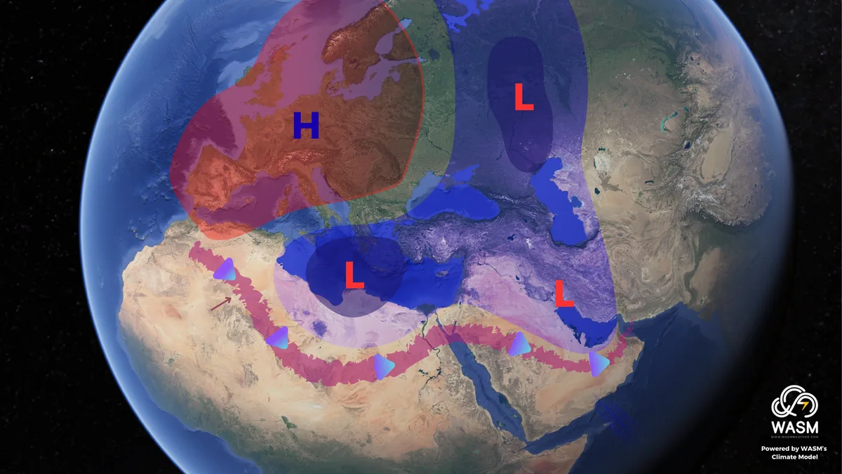
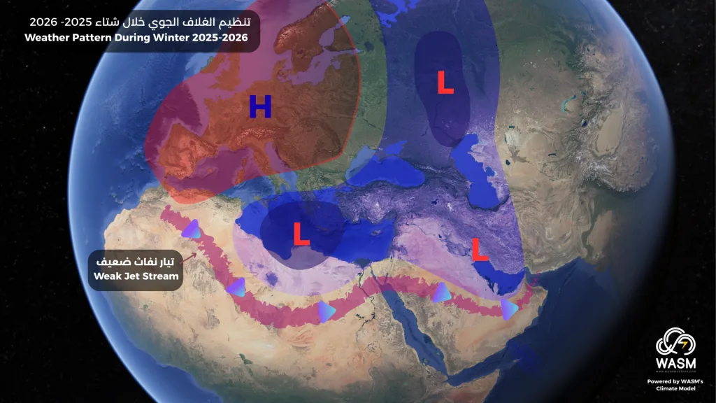
The simulation derived from data of our climate model at WASM Regional Center shows a strong high-pressure area over central Europe extending to the western parts and the western Mediterranean region and the Maghreb.
This will coincide with a "notably weak" jet stream, especially over the central Mediterranean, which will lead to the continuous pushing of cold air masses from the Atlantic Ocean and eastern Europe towards the east and central Mediterranean.
This will result in the continuous presence of a low-pressure area in both northern Libya and the northeastern Mediterranean and Turkey, as well as the southeastern Arabian Peninsula area, which will be more pronounced during the second half of the rainy season compared to the first half.
The polar jet stream is also expected to weaken "significantly" and unusually during the second half of the rainy season, leading to sharp activity on polar waves globally and in the eastern and central Mediterranean and northern Arabian Peninsula.
The western United States will experience a stormy and very cold winter with above-normal rainfall in the southern United States, while the eastern regions of the United States will experience long dry periods and warmer than normal temperatures.
Climate Factors|
A dormant phase is expected to prevail for the second consecutive season in the tropical Pacific region in general (with a weak possibility of a weak La Niña phenomenon for a temporary period not exceeding 3 months during autumn).
This climate phenomenon will gradually transform into the Modoki El Niño phenomenon by late winter and spring or mid-2026.
The negative Pacific Decadal Oscillation (PDO) will recede noticeably as a result of the expected strong storms in the northeastern Pacific, which will lead to a noticeable weakening and severe meandering of the polar jet stream.
The North Atlantic will be active and will experience strong storms but in the northern central part, coinciding with sharp meanders in jet streams, which will expose Europe to warm and dry atmospheric systems for longer periods than normal.
Waters around the equator of the Atlantic Ocean are expected to remain cooler than normal, which will also coincide with a gradual decline in temperatures in the North Atlantic region.
The phenomenon expected in the Indian Ocean is negative, as hot water continues to accumulate near Indonesia, but this index is expected to rise gradually during the second half of the rainy season, triggering the beginning of the Modoki El Niño phenomenon.
Date of Main Bulletin|
WASM Regional Center is expected to issue the main bulletin by the end of this month or the beginning of October at the latest, based on available data after the main operation of our calibrated climate model. We do not expect significant changes compared to this bulletin except for issuing more accurate details for autumn and winter.
The center will operate this model three times monthly this season and will continuously provide updates to ensure the center always issues the most accurate results.