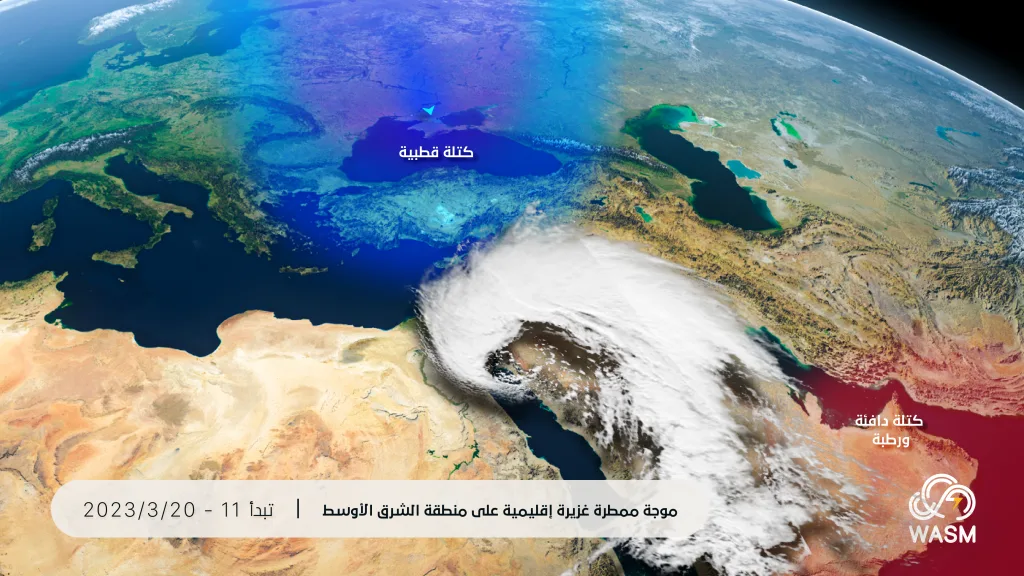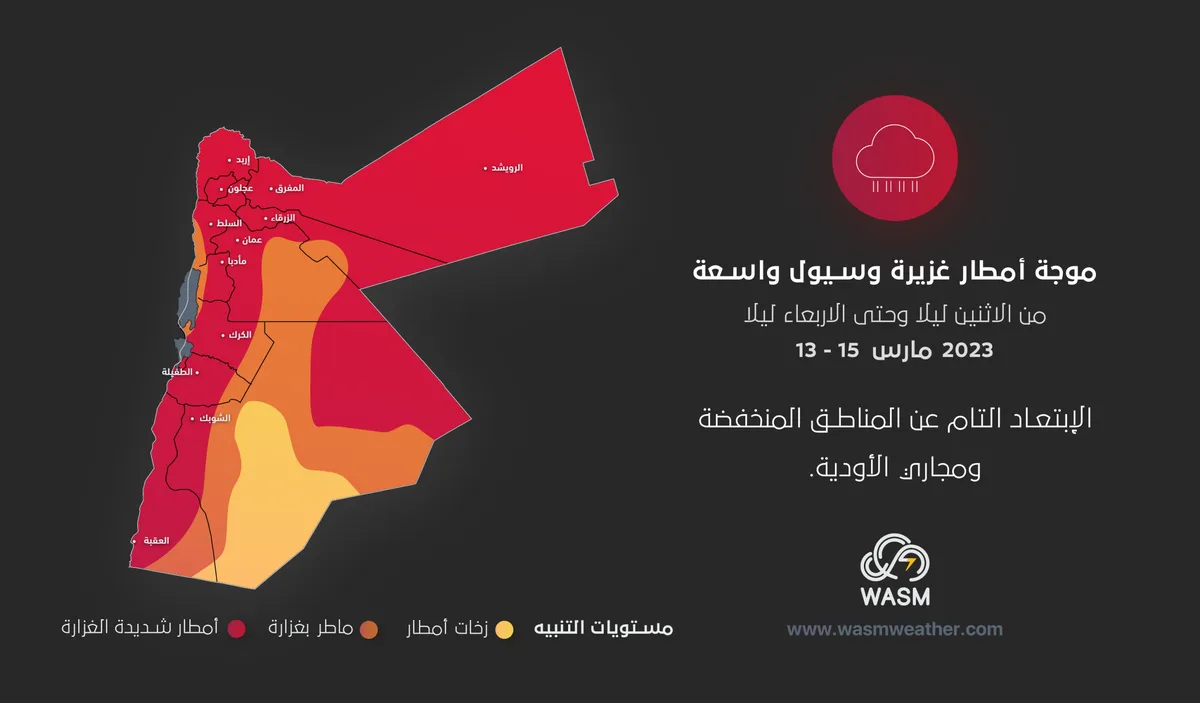
WASM- Jordan is being affected by a strong and extensive wave of floods and heavy rainfall on Tuesday and Wednesday across various regions within an "unusual" weather condition resulting from the surge of a "polar-origin" air mass coinciding with the presence of a warm and semi-tropical air mass coming from the Arabian Sea.
In detail, the weather will be mild and spring-like during the day and cold at night on Sunday and Monday, then a significant drop in temperature will occur coinciding with the impact of the low-pressure system, and very large amounts of rain will fall on Tuesday and Wednesday covering various regions and major cities, which will cause the risk of widespread flooding and torrential floods in some areas.
The low-pressure system is positioned over the Cyprus basin and is accompanied by a "polar-origin" air mass, and rainfall begins late Monday/Tuesday night in parts of the northern kingdom, extending to wide and comprehensive areas on Tuesday with very large quantities of rain falling that require taking the highest precautions and staying completely away from low-lying areas and valleys and being alert to "sudden dam flooding".
Light snow falls in the high southern mountains above 1600 meters above sea level on Wednesday dawn and morning, which is sometimes mixed with rain.
The intensity of rainfall decreases gradually after Wednesday afternoon and the weather stabilizes temporarily on Wednesday/Thursday night but with the formation of "black frost" in high mountains, especially southern ones, which requires taking the highest precautions, especially for farmers.
The kingdom is expected to be affected by another very cold air mass at the end of the week accompanied by renewed heavy rainfall in several areas and a significant drop in temperature, with strong weather conditions expected to continue until the beginning of the holy month.
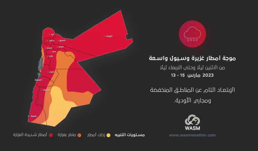
WASM is issuing a "red alert" level on Tuesday weather conditions, due to the very large quantities of rain expected in various regions which require taking the highest levels of readiness from all sectors, and the weather condition is expected to include tourist areas, Aqaba, Petra, major cities and the capital.
The reason for these strong and sudden conditions is due to an event in the Arctic region, where sharp instability in surface atmospheric pressure values is being monitored, which causes the expansion and extension of polar air in a rare manner at this time of year in various parts of the world, which is expected to cause strong weather conditions to continue until late spring.
Despite the recent rainfall break, it is not considered the end of the rainy season or the end of winter as many media outlets have announced, WASM Regional Center expects a strong return of winter conditions during late winter and spring period, and rainfall amounts are still good in various regions until this date despite the recent break and it is expected that many regions will exceed their full seasonal averages during the expected weather conditions due to the very large amounts of rainfall during these weather systems.
Usually, Jordan is affected by such rainfall breaks and temperature rises, especially at the end of winter, which is sometimes considered an indicator of expecting a strong and sudden return of winter within climatic periods called "the period of borrowed time or old man's cold" which is considered one of the most dangerous climatic periods in the region and which holds the most popular proverbs.