
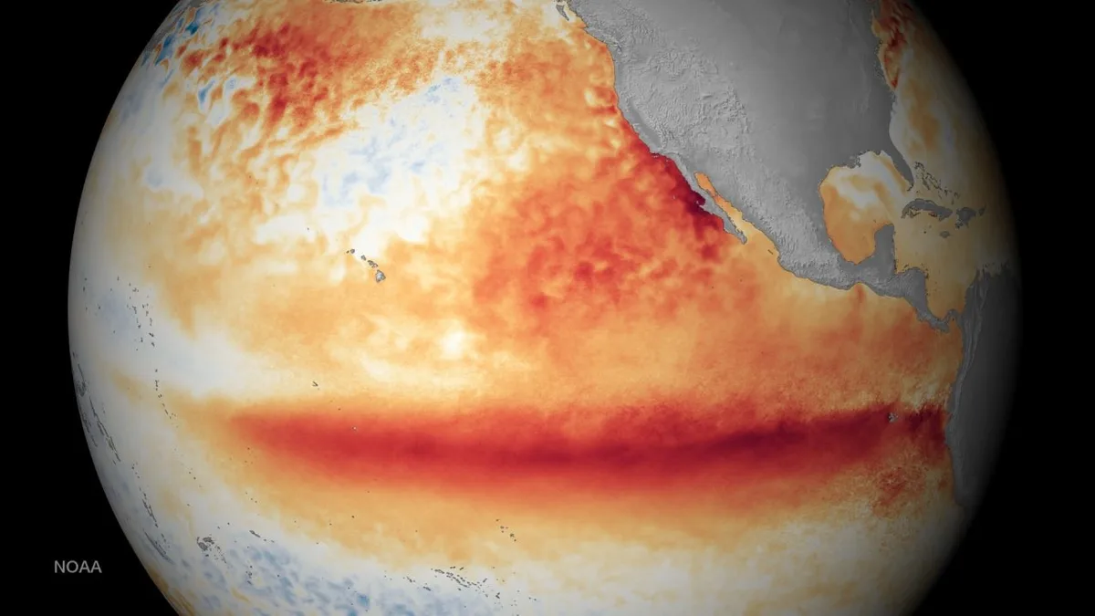
WASM - A dangerous climate phenomenon known as "Super El Niño" is developing, which is the most hazardous to the world's climate and results from a significant rise in temperatures in the tropical region of the Pacific Ocean.
After two years of rare calm in the tropical Pacific region and the absence of major climate phenomena, the El Niño climate phenomenon has begun to develop at an accelerated pace toward the end of winter, and is expected to develop formally during the late spring and early summer of 2026, which aligns with studies by WASM Regional Center conducted during the previous summer that showed exceptional success in monitoring this phenomenon, and our center's success in predicting the strong rainy season "alone" contrary to all widespread information.
Super El Niño Phenomenon|
This phenomenon is defined when the average temperature in the Niño 3.4 region rises above +2.0 to 2.5 (tropical central Pacific Ocean), and forecasts indicate it will reach more than 2.5 for an extended period during the coming season, which reflects a major threat to global climate. The last phenomenon of this type was recorded during the 2015-2016 season, which recorded record rainfall amounts in most Middle East regions, and this phenomenon caused a significant increase in rainfall rates in the region even in subsequent years.
This climate phenomenon is classified as dangerous because it greatly affects global climate, increasing droughts, floods, heat waves, and cold spells in various parts of the world, and it negatively impacts many regions globally. However, its impact on the Arab region, particularly the Middle East, is more positive despite increasing cases of floods and torrential rains.
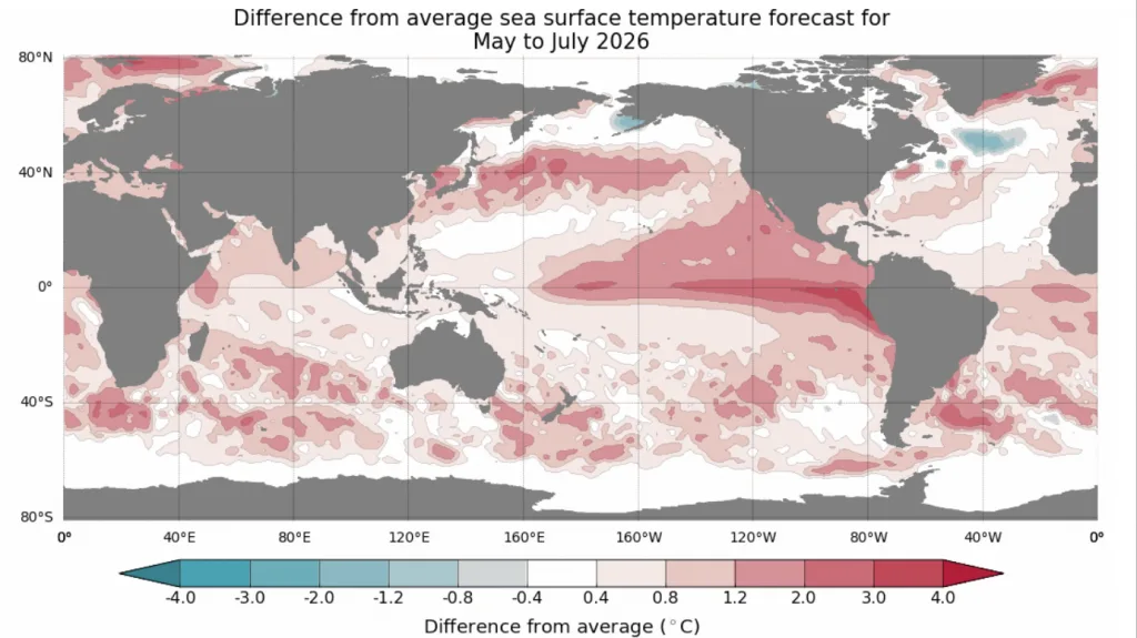
Super El Niño Phenomena: A Major and Important Cause of Increased Rainfall Rates|
With the region being affected by an exceptional rainy season, predicted solely by our WASM Regional Center in the region due to the accuracy of our climate model, as well as the recording of many strong rainy seasons over previous years, it appears we are facing an intensification of this type of climate change. A significant change in atmospheric circulation has been observed since 2015, especially after the last Super El Niño phenomenon, where rainfall rates in the region increased considerably. This phenomenon raised the probability of strong rainy seasons from 20-30% to 70% since 2015, and we expect the chances of strong rainy seasons to increase to more than 90% after 2026.
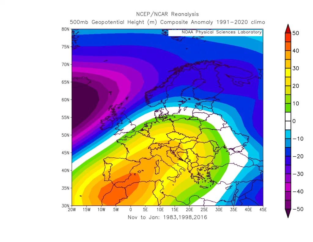
There are many factors that increase the strength of rainy seasons. Super El Niño phenomena play a very significant role in the path of the subtropical jet stream and the decline of its strength in the Middle East region through a specific circulation pattern. This specific circulation pattern will become stronger and more evident in the coming years, which indicates an additional increase in rainfall rates in the region. Perhaps rainfall amounts will exceed double in most areas during the coming rainy seasons with the intensification of this type of climate change.
Strong rainy seasons, particularly in 2019, 2020, 2023, and 2024, recorded record amounts of rainfall in the region, exceptional rainy weather cases, and a significant increase in rainfall rates exceeding double.
Convergence of Other Climate Factors That Intensify Climate Change|
Rising temperatures on the coasts of California and the Victoria region on the western side of North America greatly amplify the impact of the Super El Niño phenomenon. This phenomenon may significantly weaken the monsoon winds in the Arabian Sea region and may indirectly cause a large portion of these winds to deflect toward the south of the Arabian Peninsula, also causing an important and dangerous change to the subtropical jet stream in the Middle East region, increasing cases of heavy unseasonable rainfall, which may increase in strength compared to the summer 2023 cases.
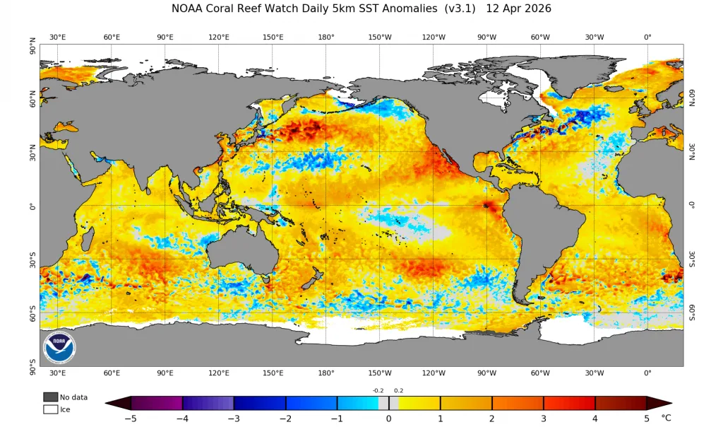
With the observation of cold currents flowing in the tropical and subtropical Atlantic Ocean region, this leads to a continuous decline in the strength of the subtropical jet stream in the Mediterranean region. This results in the surge of more cold masses toward the mid and lower latitudes and the intensification of rainy conditions and the extension of their impact in an unseasonable manner.
The Super El Niño phenomenon plays a major role in promoting these new climate phenomena. Global climate will enter a new, more dangerous, and more extreme phase in the coming years, threatening global agricultural sectors and energy.
Increased Number of Hurricanes and Storms in the Region|
The Super El Niño phenomenon will lead to a global rise in temperatures. High global temperatures mean vast latent energy. With the presence of other factors that lead to its depletion in the form of thermal energy converted into large kinetic energy that powers these storms and hurricanes with a specific atmospheric organization that transfers depletion zones to specific global zones.
With the development of a climate model operating through flexible statistical calibration methodology at WASM Regional Center, these zones are easily identified and concentrated in the eastern Mediterranean and also the western Indian Ocean region and the Arabian Sea. With the weakening of the jet stream, this will increase the strength of storms in the region and their severe impacts.
The number of hurricanes may exceed the historic 2020 season, where our climate model was able to predict with great accuracy the expected number of hurricanes, which was classified as the strongest in the history of climate records. All eyes are now directed toward the 2026-2027 season, which may easily exceed these figures with the weakening of the jet stream strength in the region, leading to an increasing threat to Oman, Yemen, Socotra Island, and Somalia, and dangerous indirect impacts on most regions of western and southern Saudi Arabia.
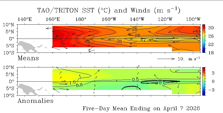
Subtropical storms or medicane storms in the eastern Mediterranean will also intensify further in the region, especially during the coming autumn and winter, which increases danger to Palestine, Egypt, Jordan, and the southern Lebanese coasts primarily, as well as northeastern Libya (according to results from our model).
Unseasonable Rainy Weather Cases|
The increase in the number of unseasonable rainy weather cases will become more evident during the coming rainy seasons. A clear increase in their number has been recorded in recent years, particularly during summer 2023, when several strong rainy weather cases were recorded in June, causing historic floods and torrential rain in the Levant region, eastern Mediterranean, and Jordan.
The number of these cases will become more frequent in the region, especially with the increase in rainfall rates in recent years, resulting from a significant weakness in the subtropical jet stream and the activity of tropical waves moving toward the region.
Hotter Summer in Europe|
A significant repetition of strong heat waves has been observed on the European continent, resulting from an unusual circulation behavior of the atmosphere due to a significant weakness in the subtropical jet stream in the Mediterranean region, which easily causes hot masses to surge toward Europe. Super El Niño climate phenomena and their synchronization with other climate factors will lead to the intensification of heat waves toward Europe, especially during summer 2026, and a decline in their numbers in the eastern Mediterranean region as has occurred in recent years.
Heat waves will become shorter in impact, more extreme, and fewer in number in the Middle East region during the coming years, reflecting clear climate changes in the region.
El Niño Phenomena Have Become More Frequent|
El Niño phenomena have recurred in the Pacific Ocean after the Super El Niño phenomenon in 2015, which played an important role in intensifying climate change and increasing rainfall rates in the region. With the failure of La Niña phenomena to develop over the last two years, contrary to expectations, we may notice a scarcity of climate La Niña phenomena and an increase in the number of El Niño phenomena, which puts global climate at a very dangerous turning point that requires monitoring by all global centers and complete global preparedness.