
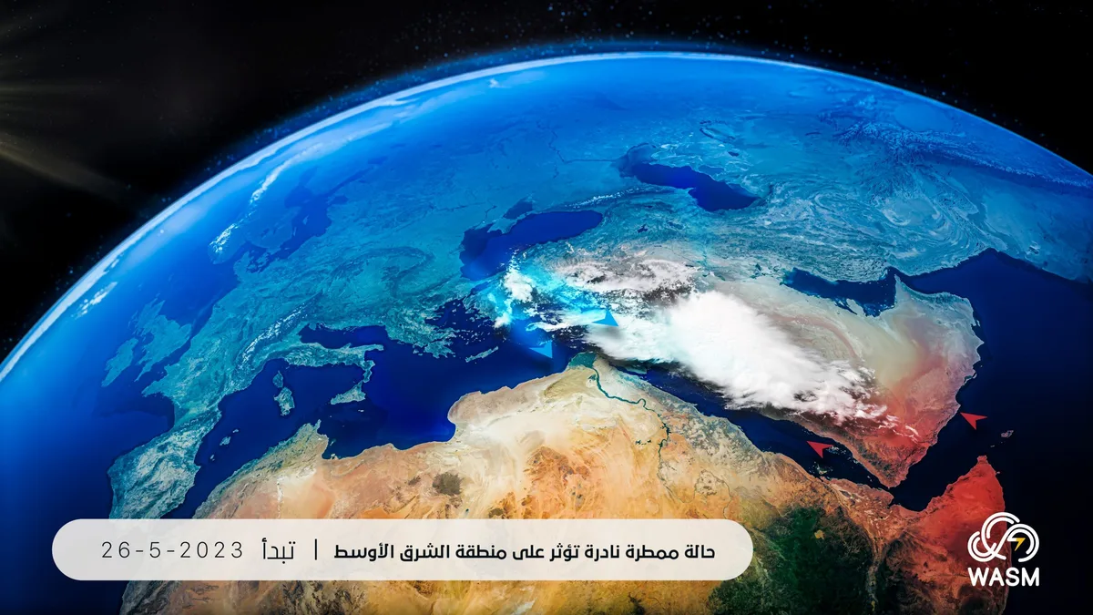
WASM- The Kingdom will be affected starting from Saturday with unusual atmospheric disturbances and a rare unseasonal rainy condition compared to this time of year, with thunderstorm rainfall expected in various regions of the Kingdom, sometimes heavy during the beginning of next week.
In detail, temperatures will fluctuate slightly again during the weekend with occasional wind activity and increasing clouds at different altitudes and rain showers falling in various regions of the Kingdom.
An unusual low-pressure system approaching the Kingdom..
An unusual atmospheric low-pressure system is approaching the Kingdom with the beginning of next week and is centered around Cyprus, coinciding with the surge of humid seasonal winds toward Egypt and the northern Arabian Peninsula and Jordan, causing increased thunderclouds and rainfall in many areas.
Maximum temperatures will drop slightly and register around 28°C in the capital and mountains during the atmospheric disturbances and rainfall, with expected temperature fluctuations with the impact of thunderclouds and wind activity.
Rainfall is expected to be heavy in some areas causing the formation of floods and flash floods, coinciding with strong winds and dust stirring and lack of horizontal visibility especially in desert areas.
Unusual weather condition..
Rainfall occurs at this time of year but rarely, and the rainy condition and weather disturbances are expected to be strong in some areas during the beginning of next week which increases the occurrence of floods in many areas.
The Kingdom continues to be affected by atmospheric disturbances with occasional rain showers in some areas as a result of an unusual atmospheric circulation pattern which is expected to continue until the first half of June, and temperatures continue to record below their seasonal averages.
The weather condition is expected to affect Egypt, Palestine, Sudan, western and northern Saudi Arabia, Iraq, a wide range of the Levant region, Turkey, and the Mediterranean Basin.
Scientific reasons for the weather condition..
With the beginning of summer, atmospheric pressure drops sharply in subtropical regions, especially the Arabian Peninsula, Iraq, and Kuwait due to extreme temperature rise, which causes the beginning of the surge of seasonal winds toward southern Arabian Peninsula and India.
However, due to the current atmospheric circulation pattern and the continued surge of cold air masses toward the mid-latitudes region and the Mediterranean Basin area, this caused a change in the positions of subtropical low-pressure systems and their movement in a wave-like manner toward the Mediterranean Basin region as well as the mid-latitudes. This unusual movement caused the surge of humid seasonal winds toward the mid-latitudes in a rarely occurring manner parallel with subtropical and tropical waves.
The drop in atmospheric pressure over Egypt, northern Arabian Peninsula, and the Mediterranean Basin region and its rise at the same time over southwest Asia caused a change in the direction of seasonal winds to the Arabian Peninsula and in a very rare manner toward Egypt and then Jordan, the Mediterranean Basin region, which is expected to continue at intervals until the first half of June at least.
Despite the formation of frontal low-pressure systems also in the southern Mediterranean Basin region merged with the subtropical low-pressure system resulting from rare atmospheric organization and weak subtropical jet stream, this caused the surge of seasonal winds also toward a wide range of the Sahara Desert and the Mediterranean Basin region and Egypt and the Arabian Peninsula, causing heavy thunderstorm rainfall to move toward extremely arid and low-rainfall areas.
These changes and this organization is due to many reasons, most importantly the rise in the temperature of water bodies coinciding with significant cooling in the upper atmosphere region.
These weather conditions will become increasingly evident especially with the second half of summer season, causing strong temperature fluctuations and unprecedented heavy rainy waves in many areas of the southeastern Mediterranean and the Arabian Peninsula.
WASM Regional Center will continue to issue alerts and warnings about weather conditions expected to be strong in many areas.