
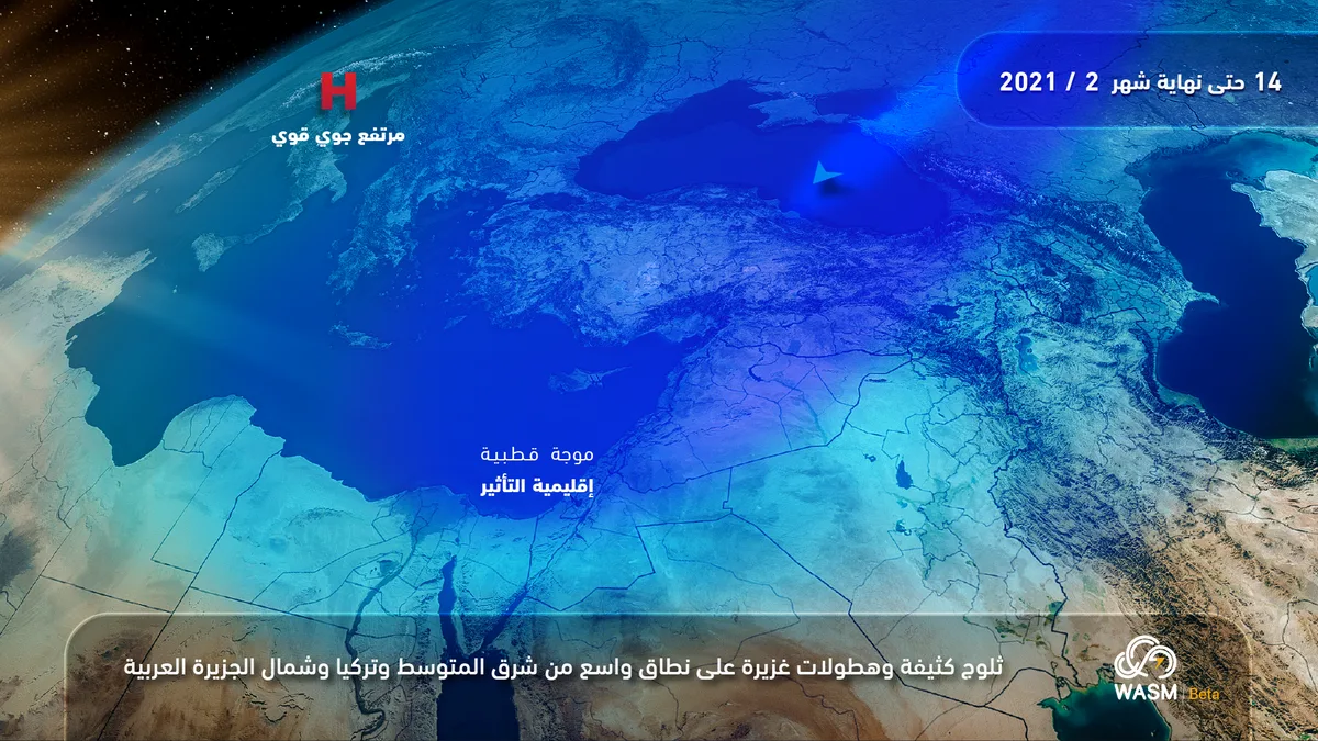
WASM – Jordan is expected to be affected by a strong polar wave accompanied by heavy snow and strong winds in the middle of next week, starting Tuesday and continuing until the end of the month in periods of varying intensity, coinciding with a significant temperature drop and heavy rainfall in low-lying areas.
WASM classifies the weather condition as a "strong polar wave" with indicators of its development into a snowstorm affecting Jordan, while at the same time affecting wide areas of Turkey, the Levant, Iraq, Eastern Europe, Iran, and northern Arabia, which is classified as a regional snowstorm. WASM will issue all details regarding the intensity of this strong polar wave, which is expected to last for many days.
Temperature will drop tomorrow, Friday, with scattered low clouds appearing and limited light rainfall occurring. Starting Sunday, Jordan will be affected by the leading edge of the deep weather depression accompanying the strong polar wave, with temperature rising again then noticeably dropping in the evening of Monday and morning of Tuesday, coinciding with strong wind activity stirring up dense dust across all areas.
The strong polar wave will begin affecting Jordan on Tuesday accompanied by heavy precipitation and snowfall in elevated areas and heavy rainfall in low-lying areas. Changes to this weather condition are possible, as its intensity will vary during its impact, intensifying at times and weakening at others due to the magnitude of this polar wave and the length of its duration. Its impact is expected to be widespread, affecting all areas of Eastern Europe, Turkey, Iran, Arabia, the Eastern Mediterranean region, Jordan, the Levant, and even northern Egypt.
.
To know the temperatures in your cities, please visit the following link.. www.wasmweather.com