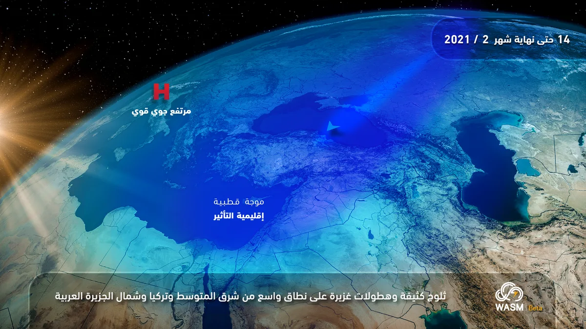
WASM- Jordan is affected by a "strong" polar wave which is expected to escalate into a snowstorm beginning Tuesday evening and continuing for several days, resulting in heavy rainfall and heavy snow on mountainous areas.
The polar wave will begin to affect Jordan on Tuesday evening in the form of heavy rain, strong winds, and heavy snow on high mountains exceeding 900 meters during the night. The intensity of precipitation will slightly decrease Wednesday morning and intensify again Wednesday afternoon and evening as Jordan is affected by a new cold front of polar origin, resulting in heavy snow accumulation on elevations exceeding 600 meters and sometimes below that, accumulating densely on mountain plateaus including the capital Amman.
Wind speeds are expected to reach 70 km/h with gusts exceeding 100 km/h, stirring up dense dust during Tuesday daytime before the onset of heavy precipitation.
The polar wave is expected to continue for several days, with periods of intensification and weakening. The polar wave is expected to intensify again at the beginning and middle of next week.
WASM recommends following the warnings issued by the Jordanian Meteorology Department, General Security, and Civil Defense, which are considered the only official warnings.
In scientific detail, a strong and deep atmospheric high is pushing an extremely cold polar air mass from latitude 80 degrees north near northern Siberia across Eastern Europe and Turkish territories to the eastern Mediterranean. Due to the massiveness of the air mass and its extreme coldness, a storm is expected to form in the eastern Mediterranean as a deep atmospheric low with a central depth reaching approximately 995 millibars, accompanied by polar air. Because of the massiveness of the polar air mass and the continued positioning of the strong atmospheric high over Europe, this air mass is expected to remain stationary for a long period over Turkey and the eastern Mediterranean, indicating the continuation of the snowstorm's impact for many days.
To know temperatures in your cities, please visit the following link.. www.wasmweather.com
Weather Alert: Strong polar wave with heavy snow and intense rainfall beginning Tuesday evening and lasting for an extended period