WASM- With the beginning of spring's influence on the Mediterranean region, atmospheric low-pressure systems continue to be active in the area and may even exceed their winter intensity in some years, but what are Khamsin low-pressure systems? How do they form? What are the weather conditions associated with them? Why have they weakened and declined in recent years? And are they important for rainy conditions in the Mediterranean region?
Khamsin atmospheric low-pressure systems..
They are atmospheric systems that develop due to baroclinic atmospheric instability resulting from a sharp latitudinal thermal contrast, triggered by the activity of Mediterranean fronts associated with Mediterranean low-pressure systems. They begin to form over the hot regions of North Africa compared to the cooler Mediterranean Sea, meaning that Mediterranean atmospheric low-pressure systems are an important catalyst for the development of baroclinic atmospheric instability systems.
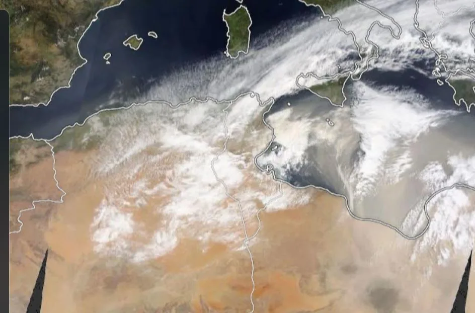
Khamsin low-pressure systems are accompanied by cold and warm air fronts, but they are usually extremely dry low-pressure systems accompanied by strong, dusty winds, especially in the active zone that separates hot air from cold air (the cold front zone). As a result of active vertical and horizontal wind movement in that active zone, it contributes to the spread of dust and sand to the deep upper layers. Depending on the very low humidity ratio in the hot zone, this leads to the presence of medium and sometimes high clouds.
Weather phenomena concurrent with Khamsin atmospheric low-pressure systems..
Dust storms or dusty atmospheres, and strong winds that may sometimes reach gusts of 80 km/h and exceed that in the case of "Khamsin storms," light and sometimes muddy thunderstorm showers, very significant temperature differences that may exceed 20 degrees Celsius within a few hours.
It is evident from the description the characteristics of strong baroclinic instability conditions but with extremely dry characteristics (meaning that air moves vertically and horizontally effectively but humidity levels are low for water content suitable for significant rainfall).
Khamsin low-pressure systems clearly trigger atmospheric disturbances in the Arabian Peninsula and Red Sea region through active winds and the appearance of thunderclouds and rainfall showers. Sometimes they may lead to the development of heavy and strong widespread rainy conditions if high humidity is available.
How do these Khamsin atmospheric low-pressure systems form?
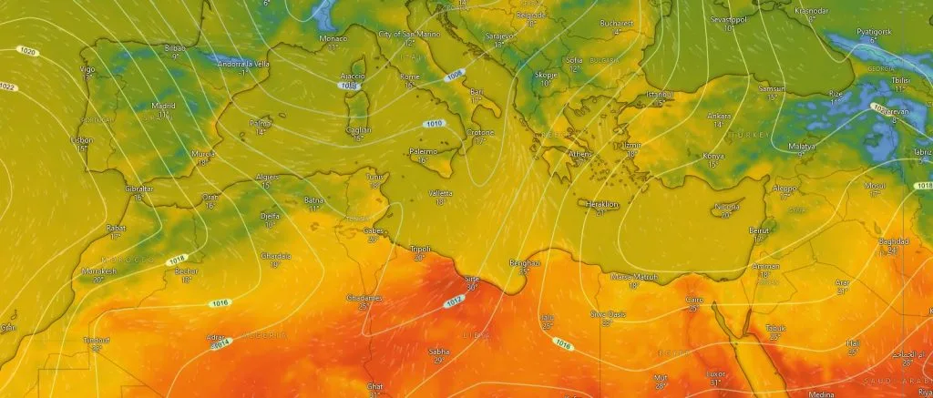
The spark of Khamsin low-pressure systems begins in the region located behind the Atlas Mountains in the Maghreb region, and during the passage of cold fronts associated with Mediterranean low-pressure systems or Mediterranean storms that continue in their activity, the positioning of nascent polar air masses changes to become "transverse" and at a sharper angle to the latitude lines in the Mediterranean region, where the degree of intersection between cold polar masses and latitude lines can reach less than 30 degrees in the central Mediterranean.
This phenomenon is due to the active subtropical jet stream over North Africa, and as a result of the significant increase in heat at the beginning of the African coastal zone with the beginning of the sun's apparent movement toward the northern hemisphere, this process leads to driving very hot winds toward North Africa during the passage of Mediterranean storms.
The towering Atlas Mountains block the passage of cold fronts and, enhanced by hot winds rushing from very hot North Africa, this quickly leads to the separation of part of the Mediterranean nascent front north of the Atlas Mountains, also enhanced by the thermal difference of the cooler Mediterranean waters from the Sahara. This fragmentation of the cold front means the beginning of the development of a low-pressure core south of the Atlas Mountains rapidly and the beginning of the formation of a Khamsin low-pressure system that begins to move with the strong westerlies that separate hot and cold air in the region and toward the east and over the southern coasts of the Mediterranean, in conjunction with the movement of the parent Mediterranean storm that caused its formation.
This process greatly enhances the great thermal exchange between the very hot African lands and the very cold European regions, and contributes greatly to the process of thermal balance in the atmosphere.
Khamsin low-pressure systems are sometimes capable of developing into strong Khamsin storms that combine their characteristics with strong Mediterranean storms, and may sometimes lead to highly extreme weather conditions in the Mediterranean region, such as what happened in the March 1998 low-pressure system in the eastern Mediterranean region, or the Dragon storm in March 2020.
Why have Khamsin low-pressure systems declined and weakened?
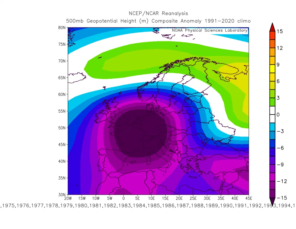
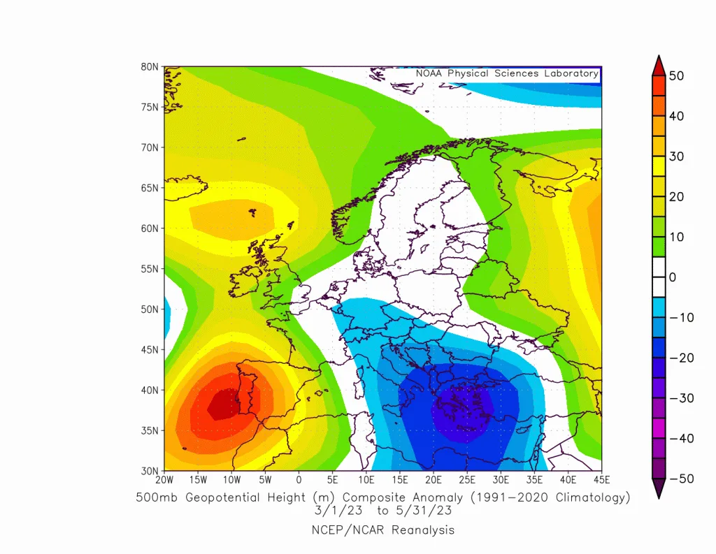
Despite atmospheric turbulence in recent years for reasons that are not completely understood, a significant decline in Khamsin low-pressure systems has been observed. Looking at weather maps across the upper and middle atmospheric levels, a near absence and significant decline in lows and storms in the western Mediterranean region during spring has been noted compared to previous years (which are considered the main trigger for the formation of these atmospheric systems as explained). A strong high-pressure system controlling southwestern Europe and the western Mediterranean changed the characteristics of polar air mass surges to become "transverse" during spring, becoming more concentrated on the eastern Mediterranean.
The development of Khamsin low-pressure systems in those areas is much less compared to other areas due to the absence of mountains that trigger the development of these atmospheric systems over North Africa.
Are there Khamsin low-pressure systems expected in spring 2024?
With the analysis of weather maps and computer models, a noticeable weakening and decline of North Atlantic storms has been observed in the past 10 days and clearly. This decline will allow polar air to reach western Mediterranean regions (where it was explained in the results of our climate model released in autumn 2023). It is not expected that the number of Khamsin low-pressure systems will reach the normal and usual average, due to the continued control of the Azores high-pressure system over southwestern Europe and North Africa.
Spring 2023 rarely recorded any activity of a fully integrated Khamsin low-pressure system, due to the continued positioning of a strong high-pressure system over most western and central Mediterranean regions and southwestern Europe. Instead, Mediterranean storms continued to be active for a long period.
Identifying Khamsin low-pressure systems is often not easy because they possess specific characteristics that differ from Mediterranean storms characteristics, especially in terms of their vertical depth and their method of formation and movement.