WASM – The pace of climate change in the Middle East has accelerated markedly over the past two years, with a substantial increase in rainfall amounts and a clear shift in the timing of precipitation. These changes have been repeating in recent years through atmospheric phenomena never before recorded in modern climate archives — a result of what we describe as “climate inversion.” But what exactly is happening?
Through a series of important studies conducted by the WASM Regional Center on the scientific causes behind rising rainfall rates and their extension beyond their usual seasonal window, it has become evident that the primary driver is an unusual behavior in the upper‑level jet stream, which has begun to exhibit pronounced waviness over the Atlantic Ocean, the Mediterranean Basin, and Europe.
Severe Jet Stream Meandering
The jet stream is a band of high‑speed winds blowing at altitudes between 9 and 12 km above sea level. It forms the boundary between warm and cold air masses and is responsible for major weather disturbances, atmospheric variability, and the overall organization of the global circulation. It is essentially the steering mechanism of weather systems.
Over recent years, the jet stream has undergone significant changes due to rising ocean and sea temperatures, particularly over Europe, the Atlantic Ocean, and the Mediterranean.
With the Mediterranean Basin warming substantially in recent years, a clear weakening of the jet stream has been observed over southern Europe — especially around France and Italy — accompanied by partial fragmentation. This weakening has extended toward northern Egypt and the eastern Mediterranean, allowing hot desert air masses to surge more easily into Europe, doubling the frequency and intensity of heatwaves to unprecedented levels.
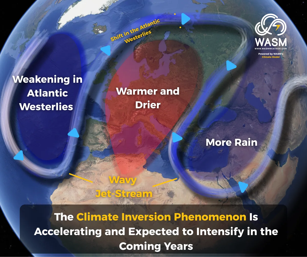
This meandering of the jet stream, combined with rising temperatures across Europe, has intensified drought and heat extremes. The resulting waviness has also transported cooler‑than‑normal air masses toward southeastern Europe and the eastern Mediterranean, initiating what we refer to as “climate inversion,” a phenomenon that began to emerge around 2015 and has accelerated in recent years.
A major factor amplifying this jet‑stream waviness is the sudden appearance of cold waters in the North Atlantic, caused by salinity disruptions linked to rapid ice melt in the region. This has produced significant anomalies in the direction and speed of the warm Gulf Stream current.
Consequently, a sharp and unexpected displacement of the polar jet stream — crucial for guiding Atlantic storms and westerlies that supply western Europe with continuous rainfall and cool conditions — has been observed. This displacement has disrupted the path of Atlantic westerlies, bending and weakening the polar jet, and diverting a substantial portion of these systems toward far northern Europe.
When combined with the weakening of the subtropical jet stream over the Mediterranean, the result is an extreme and persistent meandering pattern over Europe. This has intensified heatwaves and prolonged their duration, followed by a southward and eastward dip of the polar jet toward eastern Europe and the eastern Mediterranean.
A Long‑Lasting System
This pattern is expected to persist for an extended period. A meaningful recovery of Atlantic westerlies is unlikely in the coming years due to the continued weakening of the Gulf Stream, which will further amplify the “climate inversion” between western Europe and the Mediterranean Basin. This assessment is based on climatological and seasonal averages, not absolute values.
In simple terms: Climate inversion will lead to wetter‑than‑normal and cooler‑than‑normal conditions in the Mediterranean — especially its eastern parts — and hotter, drier‑than‑normal conditions in western Europe relative to climatological norms.
The disruption of the jet stream, as reflected in the WASM Regional Center’s climate model, is expected to persist due to the significant anomalies affecting the Gulf Stream, which is not projected to recover soon.
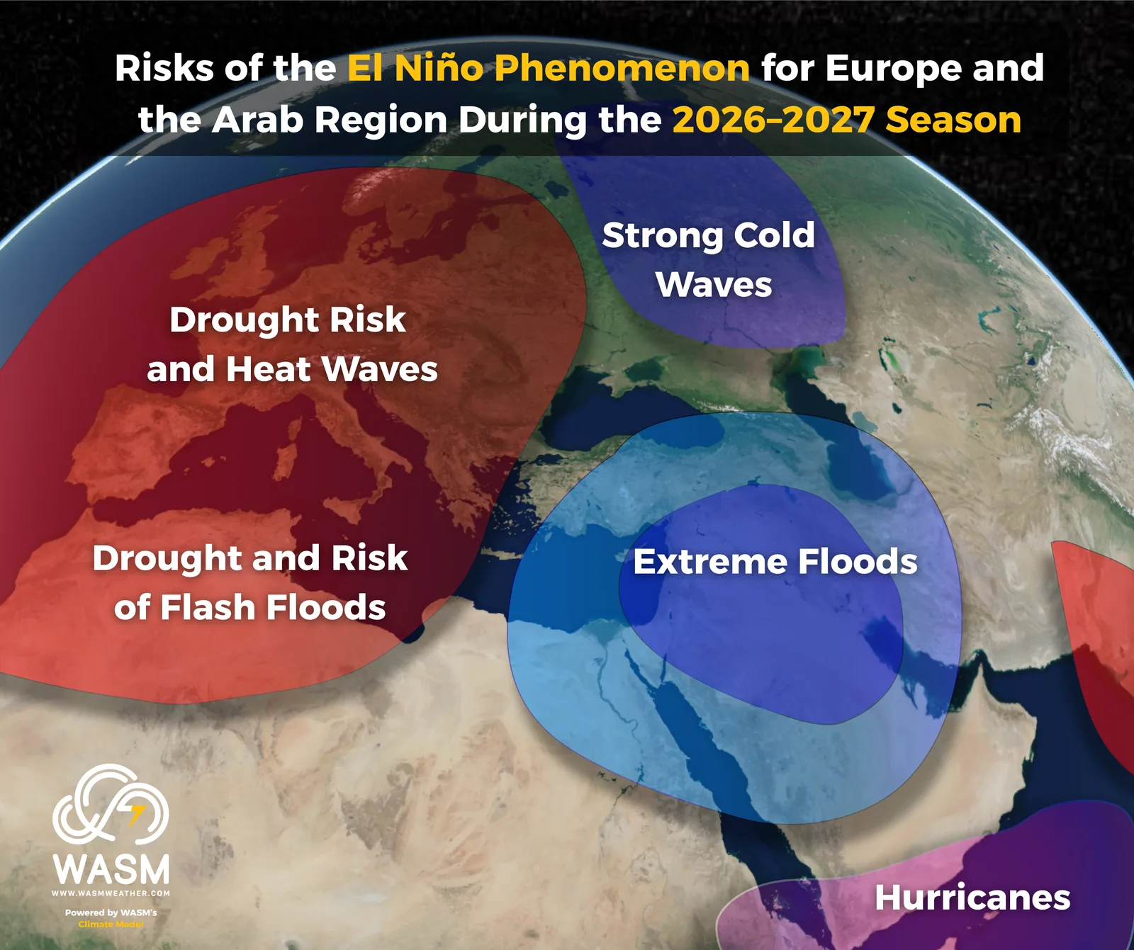
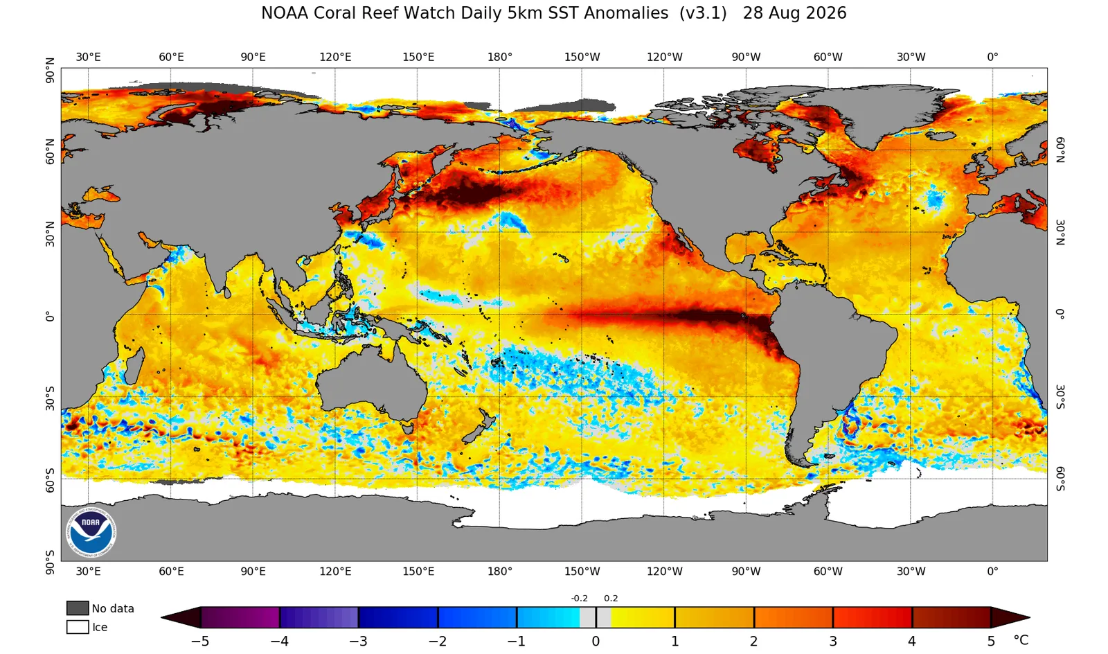
A strong El Niño event will further accelerate this climatic shift in the coming months, amplifying and prolonging its effects. At present, it remains unclear whether climate inversion is a long‑term climate shift or a multi‑year climatic cycle.
Climate Inversion
The term climate inversion between Europe and the Mediterranean is a new concept introduced by the WASM Regional Center to simplify the understanding of regional climate change for both the public and specialists — moving away from the oversimplified notion that climate change merely means “heat and drought,” a misconception often repeated in media due to poor understanding of atmospheric dynamics.
Climate inversion is a phenomenon driven by climate change, which has altered the jet stream’s path, weakened it significantly, and increased its waviness due to sharp temperature anomalies in the Atlantic and Mediterranean. This shift began roughly 15 years ago and has accelerated recently.
The initial outcomes of this phenomenon — now rapidly intensifying — include a substantial increase in rainfall across the Levant, the Arabian Peninsula, northern Egypt, central and southern Iraq, and wide areas of the Gulf region. This represents one of the most prominent climate changes in recent years.
The increasingly frequent off‑season summer rainfall observed in recent years is a direct result of climate inversion. As the jet stream bends toward Europe, intensifying heatwaves and drought there, cooler‑than‑normal air masses are displaced toward the Mediterranean and the Arabian Peninsula, enhancing rainfall events.
Outlook for the Coming Years
Based on the Wasm Regional Center’s climate model and analysis of atmospheric patterns and analog years, a sharp shift in the organization of the global circulation has been detected. Even in years when Europe would normally experience above‑average rainfall, conditions have instead trended warmer and drier. The most extreme outcomes occur in years expected to be dry (such as the upcoming season), where heat and drought intensify dramatically — producing highly extreme rainfall events in the Mediterranean, especially its eastern regions.
With the current El Niño expected to persist for at least two years due to unprecedented subsurface conditions in the Pacific and sustained warmth in the eastern Indian Ocean — contrary to typical behavior — this will significantly accelerate and intensify climate inversion in the coming years.
Although some hypotheses suggest a potential global climatic inversion leading to substantial cooling due to Gulf Stream behavior, such a shift would require many years and remains difficult to estimate due to limited and uncertain historical data.
This report is based on rigorous scientific research conducted by the WASM Regional Center. Atmospheric systems are inherently variable, and results are not absolute; they are grounded in scientific analysis. Our studies have demonstrated high accuracy in recent years, and we were the only center to predict this phenomenon and its impacts on Europe, the Mediterranean, and the Arabian Peninsula. However, long‑range climate predictions are never guaranteed.