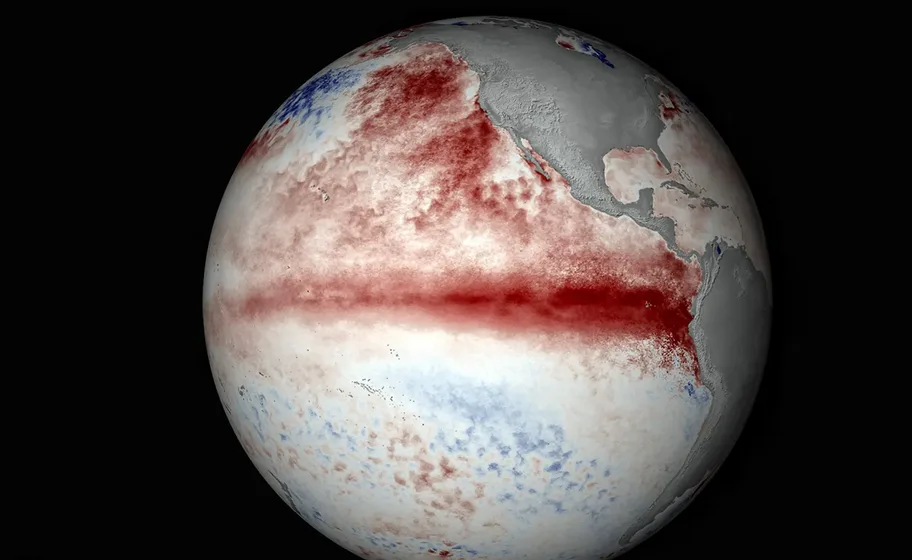
WASM- The El Niño phenomenon is developing at an accelerating pace, especially in recent days, with the beginning of detecting "westerly reversals" in the tropical Pacific Ocean region, indicating the start of the collapse of usual trade winds and the beginning of reversal of tropical circulation in the Pacific Ocean.
Latest Values|
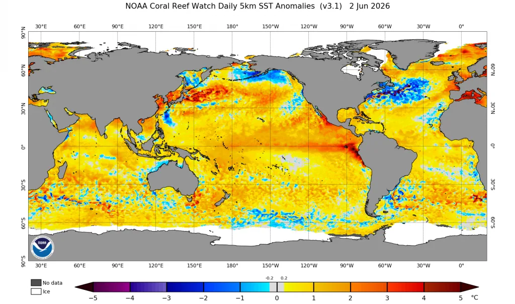
The values observed through readings from the U.S. National Oceanic and Atmospheric Administration (NOAA) indicate an increase in warming of the El Niño region, especially the eastern and central parts, exceeding 1.0 degrees Celsius above average, and the 1+2 region exceeded more than 2.2 degrees Celsius.
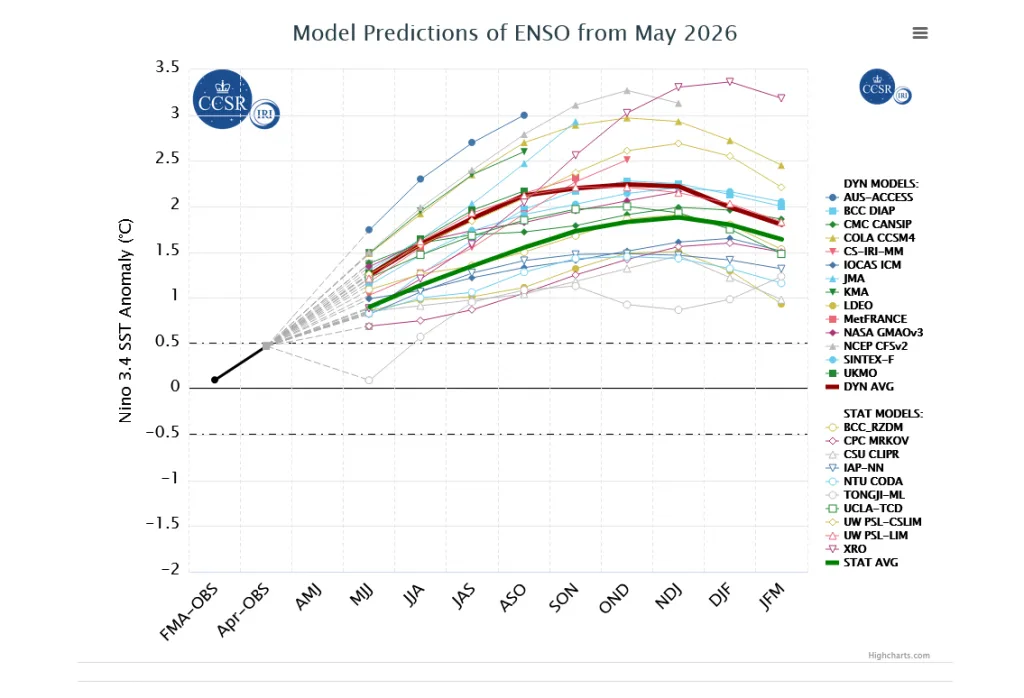
It is expected that the rate of temperature increase will rise during the coming weeks, reaching its peak during the end of autumn and the beginning of winter. According to results from various climate models of all types, the phenomenon will reach "super El Niño" levels and may be the strongest on climate records.
Reading Sub-Deep Values|
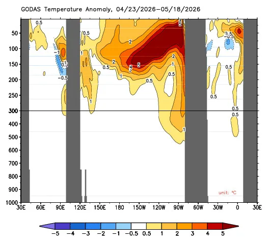
Through monitoring sub-surface-deep values in the tropical Pacific Ocean region, extremely warm waters coming from the depths are observed in the form of Kelvin waves propelled upward, leading to additional warming of the tropical Pacific Ocean region. This additional warming causes significant disruption to the movement of trade winds followed by the blowing of reverse westerlies that will increase the warming of the tropical Pacific Ocean region.
Forecasts for the Coming Months|
According to the results of global climate models, a very accelerated development of the El Niño phenomenon is expected with the arrival of warm waters from the depths, which exceed rates of more than +4 degrees Celsius in a rare and exceptional manner. The peak of this phenomenon will be at the end of autumn and the beginning of winter, leading to severe global climate fluctuations.
Impact on the Arab Region|
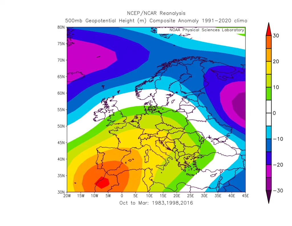
The impact of the El Niño phenomenon on the Arab region is very clear, especially with the proximity of our regions to the subtropical latitudes which are usually affected severely by this phenomenon. An increase in rainfall rates in the region at record levels is one of the most important climate effects compared to statistical results, especially in the years 1983, 1998, 2026, and 2024, when these years witnessed record rainfall quantities in the region.
However, what will distinguish this El Niño is its coincidence with different climate factors more compared to these previous years and new major climate cycles affecting the region, with the possibility that this El Niño will record the strongest values in recent climate records.
According to the results of the climate model from the WASM Regional Center, which processes many climate factors through a calibrated period-matching network (a new statistical processing method), the probability of record rainfall quantities in the Middle East region, the Arabian Peninsula, and the Levant will be very high during the coming rainy season. If this occurs, we will record a scarcity in dry rainy seasons and a wet climate cycle that has actually been affecting the region for 12 years and is gradually intensifying.
The climate studies that were released to the media were characterized by their low accuracy because they borrowed European climate reports and imposed them on the region. Our center has issued several important climate reports proving that climate change in our regions is radically different compared to what local media releases, due to misunderstanding of climate changes.
Climate changes do not mean heat and drought, but rather changes to the usual climate pattern. Arab countries should prepare for expected climate changes and improve water harvesting, which registers very poor levels, improve infrastructure and water harvesting mechanisms, restructure national meteorological departments and develop them, and fight attempts to monopolize them, which have not succeeded in recent years.
The strong El Niño phenomenon expected will change the usual global climate pattern, which may continue for many years, especially with its coincidence with the beginning of new completely different regional-global climate cycles that will increase the risks of this phenomenon, which will lead to very intense atmospheric circulation resulting from the intensification of the strong thermal exchange process that will occur in the coming years between the highly active tropical regions and the North Pole. This thermal exchange will result in exceptional strong storms around various regions of the world (detailed scientific reports to follow).